Hidden Spring Farm history of 4 Tracts in 3 satellite images
Early 1960s satellite image. Below are the four tracts that make up Hidden Spring Farm. Tract 1 bought by Bobby and Martha Jane, from relatives. Tract 2 contains the 55acre woods with spring. Tract 3 was Sam J. Bunger's "ribbon" tract. Tract 4 was Robert Sr. and Elizabeth's farm.
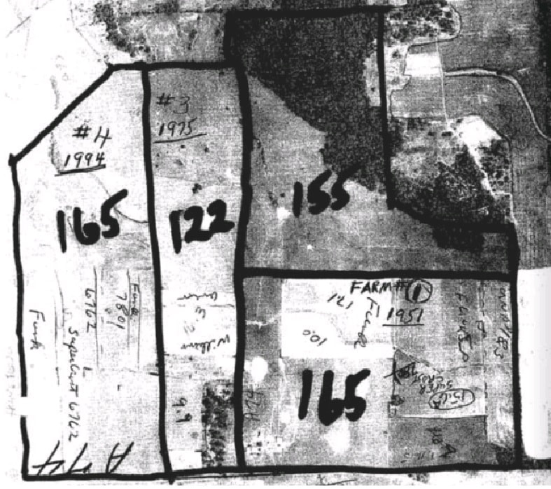
The 4 tracts
|
|


Satellite Imagery back to 1960 at https://www.historicaerials.com/viewer
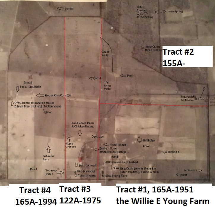
1969 satellite image. I have labeled buildings that were then visible on Hidden Spring Farm as I was growing up. For reference, the old Bunger house and property is at 6' o-clock, "Mama Elizabeth's" house is at 9' o-clock, and Boone's Spring at 1' o-clock. NOTE: the Saddleback Barn was actually a Hip Roof Barn, also known as classic Gambrel design.
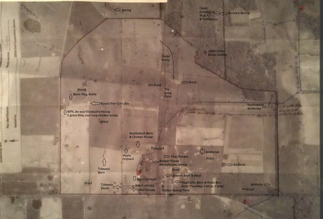
1969 satellite image of the entire property that is HSF
2012 satellite image showing Soil Conservation waterways, and the lack of fences and antiquated farm structures. From 1996-2020, we leased 470 acres to Joe Hager and his sons for row crops using all of that massive modern-day equipment. After 2012, when mom entered the hospital, we removed the remaining cattle fences after selling the herd.
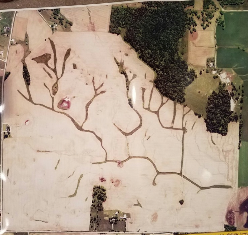
Hidden Spring Farm, 2017. Remembering sculpted waterways to prevent erosion, stretching new fences, hammering steeples, adding insulations, (then years later) removing the cattle fences steeple by steeple and post by post then rolling barbed wire and rusted wire. Picking up wagon loads of rocks to prepare the fields for seed sowing after some land was purchased in 1975.
Satellite Imagery back to 1960 at https://www.historicaerials.com/viewer
