Where is Bulger's Grove, relative to Severn's Valley in Elizabethtown, and the Blueball Hill in Rineyville?
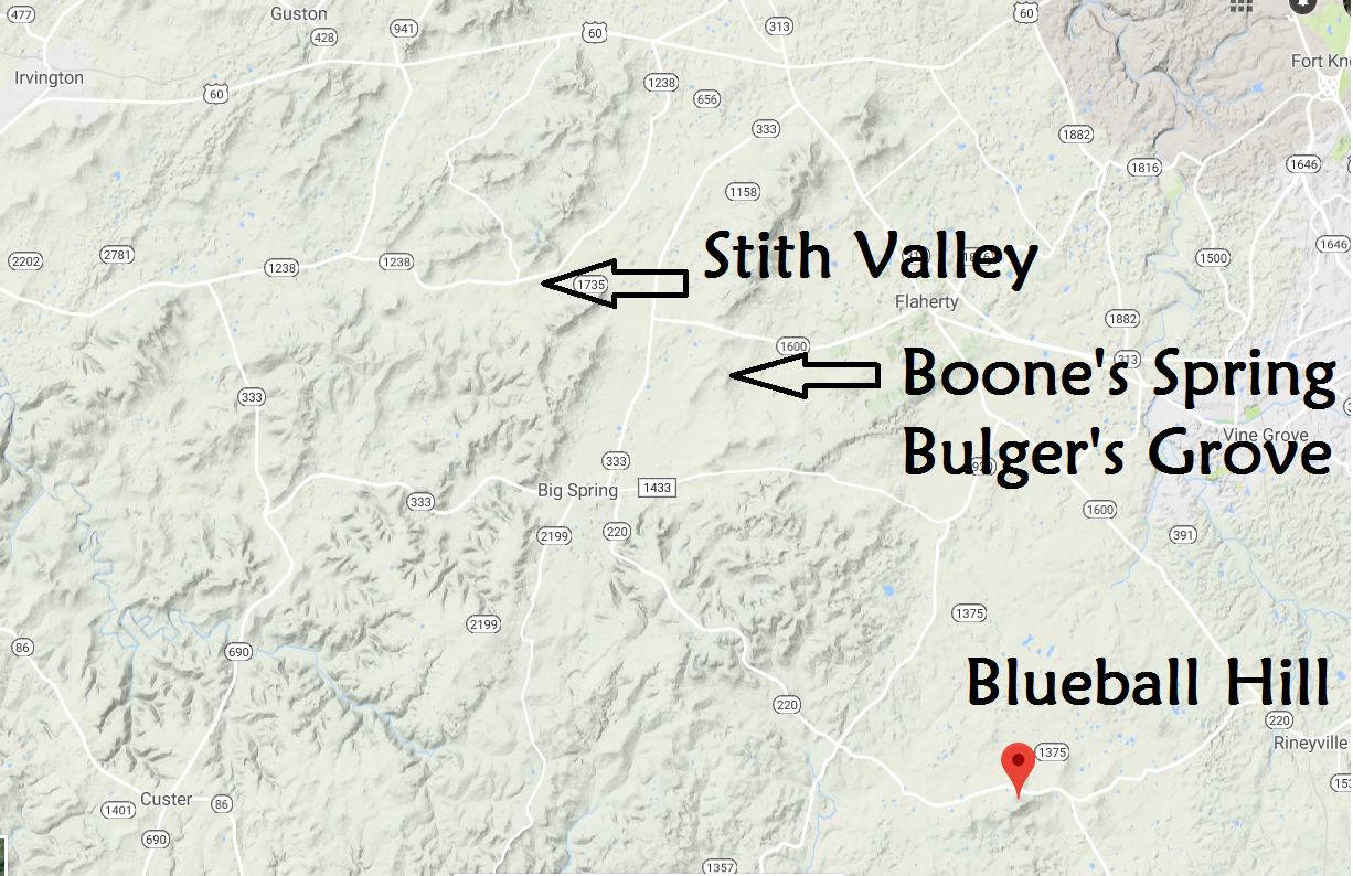
Topo Map centered on Big Spring, KY
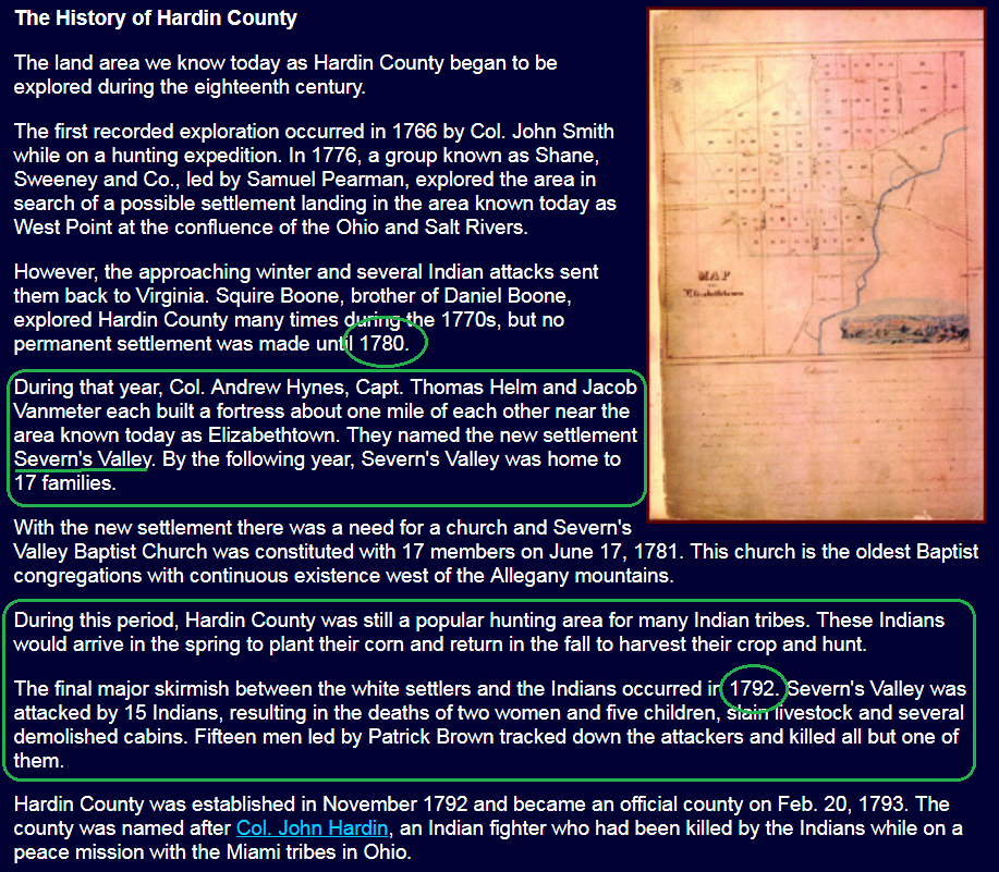
Severn's Valley settled 1780-1781
|
|
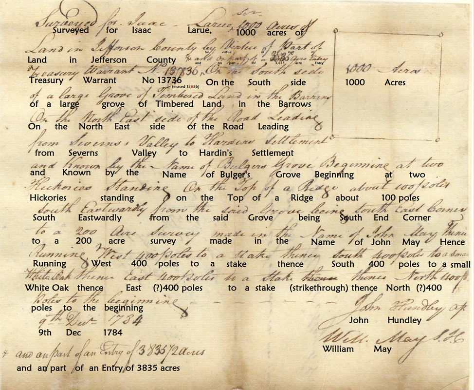
Land Survey "Known by the name of Bulger's Grove"

OK_1057-3 Transcript
|
VA Treasury Warrant No. 13736, survey of 1000 acres by Isaac Larue, on part of the 3,835 acre tract
Surveyed for Isaac Larue, 1000 acres of Land in Jefferson County (by virtue of part of, and on part of 3,835 acre entry) Treasury Warrant No 13736
|
|
1782 AUG 7th - date on OK 1057_1, the VA Treasury Warrant, No 13736, for survey of 3,835 acres for Meredith Helm
1783 FEB 2nd - date on OK 1057_2, the reverse side of VA Treasury Warrant No. 13736, signed Isaac Larue 1784 DEC 9th - date on OK 1057_3, 1,000 of 3,835 acres Survey for Isaac Larue, signed John Hundley and William May |
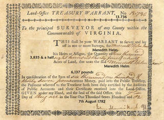
OK_1057-1
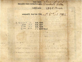
OK_1057-2
|
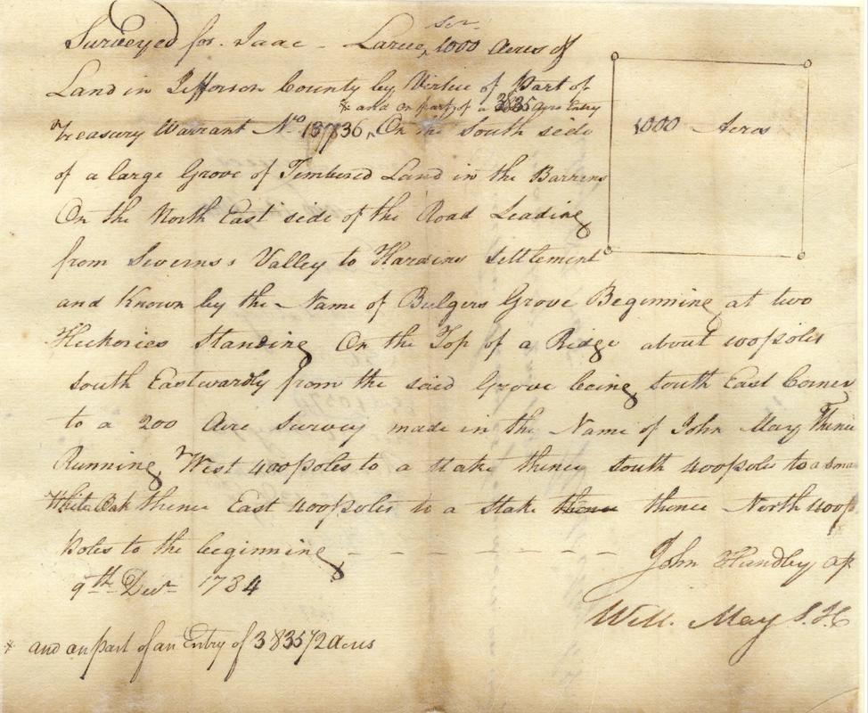
OK_1057-3
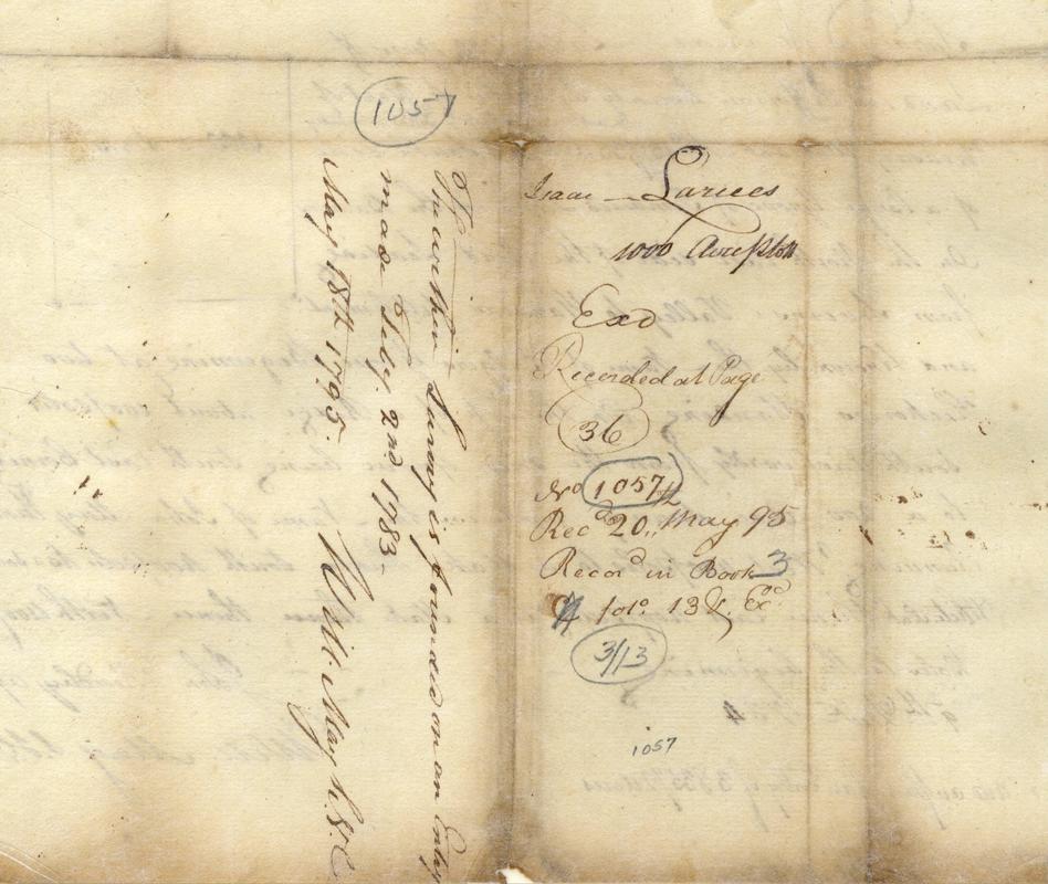
OK_1057-4
|
Other important dates referring to either Bulger's claim or the Bulger's Grove tract
*1782 AUG18(19) Battle of Blue Lick; Maj. Edward Bulger killed.
1783 Squire Boone deposes that the entry of Isaac Larue was "by my direction and adjoining the same" (referring to the Bulger Grove tract he passed through in 1780)
1793 John May purchased Bulger's claim, received a patent for the "Bulger Grove tract".
1797 an entry by Squire Boone adjoined an entry made by Edward Bulger.
NOTE: (*) asterisks before year sourced at Archaeological Investigations at Daniel Boone's Station, Fayette County, Kentucky, Uploaded by Nancy O'Malley
Other property in Old Jefferson associated with Bulger
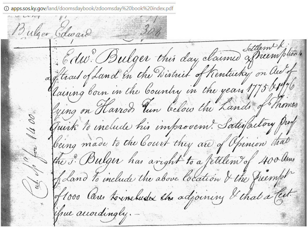
...lying on Harrod's Run (Prospect, Louisville) claim of Edward Bulger from 1775 or 76